Define the Model Domain
The model domain should be defined according to the objectives of the project.
For overland flow (OL) models, the domain should primarily follow the surface water catchment boundaries.
For saturated zone (SZ) models, groundwater catchment boundaries should be considered, while for fully integrated models, both surface water and groundwater catchments should be taken into account as far as possible.
If you want to read the steps, how to start a new project in QGIS, please jump to this section:
-
Review the available topographic, hydrographic, and hydrogeological data to identify appropriate model boundaries.
-
Create a new polygon layer by selecting Layer → Create Layer → New Shapefile Layer.

-
Set the geometry type to Polygon and define the desired coordinate reference system (CRS).
-
Specify the output file location and click OK.
-
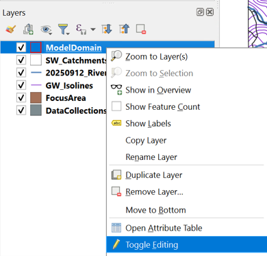
Toggle editing mode by clicking the Toggle Editing button in the toolbar.
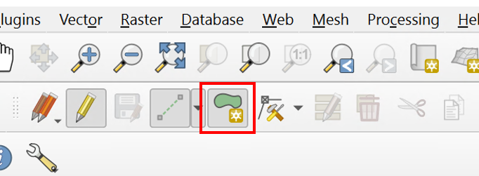
- Select the Add Polygon Feature tool.
-
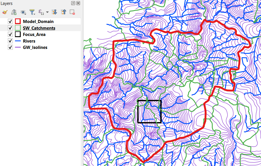
Digitize the model boundary by clicking along:
-
Surface water catchment divides derived from the DEM and drainage network.
- Groundwater flow divides where groundwater information is available.
- Boundaries perpendicular to groundwater equipotential lines where a no-flow boundary condition can reasonably be assumed.
-
Other physical or conceptual boundaries relevant to the modelling objectives.
-
Right-click to finish the polygon and save the feature.
-
Click Save Layer Edits and disable editing mode.
-
Visually inspect the resulting model domain and verify that all relevant hydrological and hydrogeological features are properly represented.
Note
The model domain should be large enough to minimize boundary effects while remaining computationally efficient. Whenever possible, place model boundaries along natural hydrological or hydrogeological divides.
Click here to jump to the next section: