MIKE SHE · Groundwater Recharge Modelling
A Practical Guide for Water Resources Assessment and Groundwater Flow Modelling

Purpose
This guide explains how to use MIKE SHE to produce physically based groundwater recharge estimates for water-resource assessments and as input to groundwater flow models such as MODFLOW and FEFLOW.
It provides a structured workflow covering data preparation, recharge model development, model evaluation, and integration with third-party groundwater models.
Overview
Groundwater recharge is one of the most influential—but also one of the most uncertain—components of the hydrological cycle. Reliable recharge estimates are essential for groundwater resource assessments, abstraction licensing, drought studies, climate-change investigations, and physically based groundwater flow modelling.
Unlike simplified recharge estimation methods that prescribe recharge as a fixed percentage of precipitation or calibrate recharge indirectly, MIKE SHE simulates the physical processes governing recharge. This allows recharge to evolve dynamically in response to changing climate conditions, groundwater levels, land use, soils, and surface-water interactions.
Whether the objective is to develop recharge maps for groundwater management or to provide transient recharge rates for MODFLOW or FEFLOW, the same physically based workflow can be applied and adapted to the complexity of the study area.
At a Glance
| Topic | Summary |
|---|---|
| Primary application | Physically based groundwater recharge modelling |
| Typical users | Hydrogeologists, groundwater modellers, consultants, research institutes and water authorities |
| Typical outputs | Recharge maps, transient recharge grids, recharge time series, complete catchment water balances |
| Typical downstream models | MODFLOW, FEFLOW |
| Required expertise | Basic groundwater modelling knowledge recommended |
| Estimated reading time | 30–45 minutes |
Typical Applications
MIKE SHE recharge modelling is commonly used for
- groundwater abstraction permitting
- regional groundwater resource assessments
- climate-change impact studies
- catchment water balance investigations
- groundwater recharge mapping
- producing recharge input for MODFLOW and FEFLOW
- integrated surface water–groundwater studies
- environmental impact assessments
Expected Outputs
Depending on the selected model complexity, MIKE SHE can produce
- mean annual groundwater recharge maps
- transient distributed recharge grids
- recharge time series
- groundwater recharge statistics
- complete catchment water balances
- infiltration and evapotranspiration maps
- surface runoff and focused recharge analyses
Documentation Roadmap
This guide is organised into the following chapters.
| Chapter | Content |
|---|---|
| 1 | Why groundwater recharge modelling is challenging |
| 2 | Why MIKE SHE? |
| 3 | Building a groundwater recharge model |
| 4 | Evaluating recharge results |
| 5 | Integration with MODFLOW and FEFLOW |
| 6 | Learning resources |
| 7 | Scientific references and case studies |
Quick Start
Who is this for?
This section provides a high-level overview of the minimum requirements for developing a physically based groundwater recharge model with MIKE SHE. If you are already familiar with integrated hydrological modelling, this page allows you to understand the complete workflow in less than two minutes.
Minimum Input Data
The following datasets are sufficient for most groundwater recharge studies.
| Dataset | Required | Typical Source |
|---|---|---|
| Digital Elevation Model (DEM) | ✓ | National mapping agencies, LiDAR, SRTM, Copernicus DEM |
| Precipitation | ✓ | Weather stations, radar products, gridded climate datasets |
| Potential Evapotranspiration | ✓ | Weather stations, ERA5, national climate services |
| Land Use / Vegetation | ✓ | CORINE, national land-cover datasets, satellite products |
| Soil Hydraulic Properties | ✓ | National soil maps, SoilGrids, field investigations |
| Model Domain | ✓ | Catchment boundary or groundwater model extent |
Optional Input Data
Depending on the objectives of the study, additional datasets can further improve the physical realism of the recharge simulation.
| Dataset | When is it required? |
|---|---|
| Initial groundwater levels | When groundwater feedback on recharge should be represented |
| River network | If groundwater–surface water interaction is important |
| Lakes and reservoirs | Where large surface-water bodies influence groundwater |
| Irrigation | Agricultural catchments |
| Groundwater abstraction | Water-resource management studies |
| Drainage systems | Lowland or drained catchments |
| Snow data | Cold climate regions |
Choosing the Right Model Complexity
One of the main strengths of MIKE SHE is that the model complexity can be adapted to the available data and project objectives.
| Objective | Recommended Configuration |
|---|---|
| Mean annual recharge map | Climate + Unsaturated Zone |
| Recharge for MODFLOW / FEFLOW | Climate + Unsaturated Zone |
| Water-resource assessment | Add Saturated Zone (3D groundwater module) |
| Hillslope recharge and focused infiltration | Add 2D Overland Flow |
| Fully integrated catchment model | Activate all relevant hydrological processes |
Best Practice
Start with the simplest model that represents the dominant recharge processes within the catchment. Additional modules should only be activated when they improve the physical realism of the simulation or are required to answer the project objectives.
What You'll Learn
This guide explains
- why groundwater recharge is difficult to estimate,
- how MIKE SHE simulates recharge physically,
- how to prepare all required input datasets,
- how to configure a recharge model,
- how to evaluate recharge results,
- how to export recharge for MODFLOW and FEFLOW,
- where to find additional learning resources and scientific references.
Continue
If you are new to groundwater recharge modelling, continue with Chapter 1.
If you are already familiar with recharge modelling, you can directly proceed to Chapter 3 – Building a Groundwater Recharge Model.
1. Why Groundwater Recharge Modelling is Challenging
Estimated reading time: 5 minutes
Key Message
Groundwater recharge is not a fixed proportion of precipitation. It is the result of interacting hydrological processes that vary continuously in space and time.
Groundwater represents the world's largest readily accessible freshwater resource and forms the foundation of drinking-water supply, irrigated agriculture, industrial production, and ecosystem functioning. Consequently, reliable estimation of groundwater recharge is essential for sustainable groundwater management.
Groundwater recharge modelling is typically performed for two principal purposes:
-
Groundwater resource assessment, where recharge defines the long-term renewable groundwater resource available for sustainable abstraction.
-
Groundwater flow modelling, where spatially distributed recharge serves as a fundamental boundary condition for numerical groundwater models such as MODFLOW or FEFLOW.
Although groundwater recharge is commonly defined as the fraction of precipitation that infiltrates through the soil and eventually reaches the groundwater table, the governing processes are considerably more complex.
Recharge continuously changes in response to
- precipitation,
- evapotranspiration,
- vegetation,
- soil hydraulic properties,
- topography,
- groundwater levels,
- river interactions,
- overland flow,
- and human activities such as irrigation or groundwater abstraction.
As groundwater levels approach the land surface, infiltration may become limited because soils become saturated. Excess rainfall is converted into surface runoff and may infiltrate again further downstream where groundwater levels are deeper or soils are more permeable. Likewise, groundwater may discharge to the surface through springs, wetlands, or lateral seepage, reducing groundwater storage and effectively acting as negative recharge.
Consequently, groundwater recharge should be regarded as a dynamic catchment-scale process rather than a simple percentage of rainfall.

Historically, recharge estimation has evolved through several generations of increasing complexity.
Early empirical approaches estimated recharge indirectly from long-term river baseflow, assuming that groundwater recharge equals the groundwater contribution to streamflow. Although these methods remain useful for first-order estimates, they neglect deep groundwater flow paths, transient storage changes, and many important hydrological processes.
Later GIS-based approaches incorporated distributed datasets such as soils, land use, climate, topography, and groundwater depth. While these methods significantly improved the spatial representation of recharge, they often remain calibrated primarily against river discharge rather than groundwater observations.
Modern integrated hydrological models extend these approaches by explicitly representing the physical interactions between atmosphere, vegetation, soils, surface water, unsaturated flow, and groundwater. This process-based representation allows recharge to emerge naturally from the simulated water balance rather than being prescribed through empirical coefficients.
Best Practice
Select the simplest modelling approach that adequately represents the dominant recharge processes within the catchment. Additional process modules should only be introduced where they improve the physical realism of the simulation.
Common Pitfall
Calibrating recharge solely against river discharge may produce unrealistic recharge estimates because groundwater observations are not considered during the calibration process.
2. Why MIKE SHE?
Estimated reading time: 8–10 minutes
Key Message
MIKE SHE does not prescribe groundwater recharge. Instead, recharge emerges naturally from the simulated water balance as the result of interacting hydrological processes.
Why is MIKE SHE different?
Groundwater recharge is not controlled by a single process. Instead, it represents the combined response of the entire hydrological system.
Depending on local conditions, recharge may be influenced by climate, soils, vegetation, groundwater levels, rivers, lakes, irrigation practices, and topography. The relative importance of these processes varies considerably between catchments.
Many conventional recharge estimation methods simplify this complexity by prescribing recharge through empirical coefficients or static soil-water balance calculations. While these approaches may be adequate for regional screening studies, they often cannot represent transient feedback mechanisms between different parts of the hydrological cycle.
MIKE SHE follows a different philosophy.
Rather than prescribing recharge, MIKE SHE simulates the physical processes governing the movement of water through the catchment. Groundwater recharge therefore becomes a calculated model result instead of a predefined model input.
This distinction is particularly important when recharge needs to respond dynamically to changing groundwater levels, climate variability, land-use changes, or human water management.
Primary Controls of Groundwater Recharge
The following processes are typically the dominant controls on groundwater recharge and are therefore considered the core components of most recharge models.
| Process | Typical influence on recharge |
|---|---|
| Precipitation | Primary water input to the system |
| Potential evapotranspiration | Controls atmospheric water losses |
| Vegetation | Determines interception, transpiration and root water uptake |
| Land use | Controls infiltration characteristics and evapotranspiration |
| Soil hydraulic properties | Govern infiltration and unsaturated flow |
| Unsaturated zone flow | Determines percolation towards the groundwater table |
| Groundwater depth | Influences soil saturation and infiltration capacity |
| Topography | Controls runoff generation and redistribution of water |
For many catchments, these processes already provide a physically realistic representation of groundwater recharge and are sufficient to support groundwater management or to generate recharge input for groundwater flow models.
Secondary Processes
Some catchments require additional processes to represent important hydrological feedback mechanisms.
MIKE SHE allows these processes to be activated only when they contribute meaningfully to the modelling objectives.
| Optional process | Typical application |
|---|---|
| 2D overland flow | Focused recharge, hillslopes, floodplains |
| River–aquifer interaction | Catchments with significant groundwater–surface water exchange |
| Irrigation | Agricultural regions |
| Groundwater abstraction | Water-resource management |
| Drainage systems | Lowland catchments |
| Lakes and reservoirs | Storage-dominated systems |
| Snow processes | Cold climate regions |
Because the model is modular, unnecessary processes do not need to be activated. This allows model complexity to remain proportional to the available data and the objectives of the study.
Choosing the Appropriate Model Complexity
One of the strengths of MIKE SHE is that it supports a wide range of modelling approaches, from relatively simple recharge studies to fully integrated catchment models.
The recommended level of complexity depends primarily on the dominant hydrological processes within the study area.
| Catchment characteristics | Recommended configuration |
|---|---|
| Flat terrain, deep groundwater, permeable soils | Climate + Unsaturated Zone |
| Moderate topography | Add distributed overland flow where required |
| Shallow groundwater | Include Saturated Zone feedback |
| Strong river interaction | Couple river and groundwater components |
| Irrigated agriculture | Include irrigation and abstraction |
| Regional water-resource assessment | Fully integrated catchment model |
This modular philosophy allows the same software platform to be applied across a wide range of projects without forcing unnecessary complexity.
A Flexible Modelling Philosophy
Another important characteristic of MIKE SHE is that physically based and conceptual approaches can be combined within the same model.
Where detailed data are available, individual processes can be represented using physically based equations. Where observations are limited, conceptual formulations or prescribed boundary conditions can be introduced without affecting the remainder of the model structure.
This flexibility enables users to balance model complexity, computational requirements, and data availability while maintaining a physically consistent overall representation of the hydrological cycle.
Consequently, MIKE SHE can support both highly detailed research applications and operational water-resource management projects.
Best Practice
Begin with the simplest configuration capable of representing the dominant recharge processes. Increase model complexity only when additional physical processes demonstrably improve the predictive capability of the model.
Common Pitfall
Adding every available process module does not automatically improve model quality. Unnecessary complexity may introduce additional uncertainty and increase calibration effort without improving model performance.
3. Building a Groundwater Recharge Model
Estimated reading time: 12–15 minutes
Key Message
A reliable groundwater recharge model starts with high-quality input data. Most modelling effort is therefore invested in preparing consistent spatial datasets before the first simulation is performed.
Workflow Overview
The recommended workflow consists of five major steps.
Project definition
        │
        ▼
Model domain
        │
        ▼
Spatial data preparation
        │
        ▼
MIKE SHE model configuration
        │
        ▼
Recharge simulation
Evaluation of recharge results and export to MODFLOW or FEFLOW are covered in the following chapters.
Step 1 – Define the Model Domain
The first step is to define an appropriate model domain.
The recommended workflow depends on whether a completely new recharge model is being developed or whether recharge is being generated for an existing groundwater flow model.
New MIKE SHE project
For new projects, the model extent should be derived from the catchment characteristics rather than only the current project boundary.
The following documentation describes the recommended workflow.
Related Documentation
These chapters explain how to
- collect the minimum required datasets,
- derive a preprocessing extent,
- define a computational domain,
- allow future model extensions.
Existing MODFLOW or FEFLOW model
If an existing groundwater model already exists, the model domain has normally been established during the groundwater model development.
In this case, the existing groundwater model boundary can generally be used directly as the preprocessing extent for the recharge model.
This significantly simplifies the workflow because the model domain preparation can usually be skipped.
Step 2 – Prepare the Required Spatial Data
After defining the model domain, all required spatial datasets should be prepared before configuring MIKE SHE.
Throughout this documentation, all preprocessing workflows are demonstrated using QGIS, although equivalent GIS software may also be used.
The preprocessing workflow consists of five independent components.
| Dataset | Purpose | Documentation |
|---|---|---|
| Digital Elevation Model | Defines terrain and computational grid | Topography Preprocessing |
| Climate | Precipitation and potential evapotranspiration | Climate Preprocessing |
| Land Use | Vegetation, roughness and land cover | Land Use Preprocessing |
| Unsaturated Zone | Soil hydraulic properties | Unsaturated Zone Preprocessing |
| Saturated Zone | Initial groundwater levels or depth to groundwater | Saturated Zone Preprocessing |
After completing these preprocessing steps, all required spatial datasets are available for building a recharge-focused MIKE SHE model.
Step 3 – Configure the Recharge Model
The required MIKE SHE configuration depends on the dominant recharge processes within the study area.
For many recharge studies, only a limited number of modules are required.
Minimum Configuration
- Climate forcing
- Land use and vegetation
- Unsaturated Zone
- Output specification
Extended Configuration
Depending on project objectives, additional modules may include
- Saturated Zone
- 2D Overland Flow
- Rivers
- Irrigation
- Groundwater abstraction
- Drainage systems
- Snow processes
The modular structure of MIKE SHE allows the recharge model to be adapted to the physical complexity of each catchment.
Best Practice
Complete the preprocessing workflow before opening MIKE SHE. Preparing all spatial datasets first makes the model configuration considerably more efficient and reduces the likelihood of inconsistencies between datasets.
Common Pitfall
Do not treat groundwater recharge modelling as a purely numerical modelling exercise. In practice, the quality of the recharge estimates is usually governed more by the quality of the input datasets than by the numerical configuration of the model.
4. Interpreting and Evaluating Recharge Results
Estimated reading time: 10–15 minute
Key Message
A groundwater recharge model should not only produce numerical results—it should provide a physically realistic representation of the catchment water balance. Recharge should therefore always be interpreted in the context of the simulated hydrological processes rather than as an isolated model output.
Typical Model Outputs
MIKE SHE can generate recharge information in a variety of forms depending on the objectives of the study.
Typical outputs include
- long-term mean groundwater recharge maps,
- transient distributed recharge grids,
- recharge time series,
- cumulative recharge,
- complete water balance summaries,
- evapotranspiration,
- infiltration,
- overland flow,
- groundwater levels,
- river exchange.
These outputs provide complementary information and should be interpreted together rather than independently.
Mean Groundwater Recharge Maps
For many groundwater resource assessments, the most important result is the long-term mean groundwater recharge map.
Such maps identify areas that consistently contribute groundwater recharge and illustrate how recharge varies across the landscape in response to
- soils,
- land use,
- topography,
- groundwater depth,
- climate,
- and hydrological connectivity.
The spatial distribution is often considerably more informative than a single catchment-average recharge value because it reveals focused recharge areas and regions where recharge is consistently limited.

Mean recharge maps are commonly used for
- groundwater abstraction studies,
- regional groundwater resource assessments,
- conceptual model development,
- steady-state groundwater models,
- communication with stakeholders.
Transient Recharge
While mean recharge maps provide an overview of long-term conditions, many groundwater models require transient recharge that varies over time.
Transient recharge reflects seasonal and interannual variations resulting from
- rainfall,
- evapotranspiration,
- vegetation dynamics,
- groundwater conditions,
- antecedent soil moisture.
Depending on project objectives, transient recharge may be exported directly for transient MODFLOW or FEFLOW simulations.
Water Balance Interpretation
Recharge should never be interpreted in isolation.
Instead, it should always be considered together with the complete catchment water balance.
Typical components include
| Water Balance Component | Interpretation |
|---|---|
| Precipitation | Atmospheric input |
| Actual evapotranspiration | Atmospheric loss |
| Surface runoff | Lateral redistribution of water |
| Unsaturated storage | Temporary storage within the soil |
| Groundwater recharge | Water entering the saturated zone |
| River exchange | Gain or loss between groundwater and rivers |
Understanding how water is partitioned between these components is often more valuable than analysing recharge alone.
Assessing Physical Plausibility
Numerical convergence alone does not guarantee realistic recharge estimates.
Recharge patterns should always be interpreted in relation to the physical characteristics of the catchment.
Typical questions include
- Are recharge rates consistent with the soil distribution?
- Do valley bottoms behave differently from hillslopes?
- Does shallow groundwater reduce infiltration where expected?
- Do impermeable surfaces generate increased runoff?
- Are recharge patterns consistent with known hydrogeology?
These questions are often more informative than comparing a single average recharge value with literature estimates.
Comparing Recharge with Observations
Groundwater recharge cannot usually be measured directly at catchment scale.
Consequently, recharge models are evaluated indirectly using multiple lines of evidence.
Examples include
- groundwater hydrographs,
- groundwater contour maps,
- river discharge,
- spring flows,
- lysimeter observations,
- regional water balance studies.
The confidence in simulated recharge generally increases when several independent observations can be reproduced simultaneously.
Best Practice
Always interpret groundwater recharge together with evapotranspiration, runoff, groundwater levels and the overall water balance. These variables provide valuable context and often explain why recharge varies across the catchment.
Common Pitfall
Avoid evaluating recharge solely on the basis of catchment-average values. Similar averages may hide substantial spatial differences that strongly influence groundwater flow simulations and water-resource assessments.
5. Integrating MIKE SHE Recharge with Groundwater Flow Models
Key Message
Groundwater recharge calculated by MIKE SHE can be used directly for groundwater resource assessments or exported as a physically based boundary condition for groundwater flow models such as MODFLOW and FEFLOW.
Overview
One of the most common applications of MIKE SHE is the generation of distributed groundwater recharge for third-party groundwater flow models.
Instead of prescribing recharge using empirical coefficients or calibration parameters, MIKE SHE produces spatially distributed recharge rates that are physically consistent with the simulated water balance.
Depending on the objectives of the groundwater model, recharge may be exported as
- long-term average recharge,
- transient recharge,
- distributed raster datasets,
- spatially averaged recharge,
- recharge time series.
These outputs can then be imported into most numerical groundwater flow models.
Choosing the Appropriate Recharge Dataset
The appropriate recharge dataset depends on the purpose of the groundwater model.
| Groundwater Model | Recommended Recharge |
|---|---|
| Steady-state model | Long-term mean recharge |
| Transient model | Time-varying recharge |
| Climate scenario | Scenario-specific transient recharge |
| Water resources assessment | Long-term recharge statistics |
Selecting the correct temporal representation is often more important than increasing spatial resolution.
Export Workflow
The recommended workflow consists of four steps.
MIKE SHE Simulation
        │
        ▼
Recharge Evaluation
        │
        ▼
Recharge Export
        │
        ▼
Groundwater Flow Model
Evaluation should always precede export to ensure that only physically plausible recharge estimates are transferred to the groundwater model.
Integration with FEFLOW
Recharge generated by MIKE SHE can be imported directly into FEFLOW as spatially distributed raster datasets.
The recommended workflow is described in detail in the following Knowledge Base article:
Knowledge Base: KA-01204
https://dhigroup-support.microsoftcrmportals.com/knowledgebase/article/KA-01204/en-us
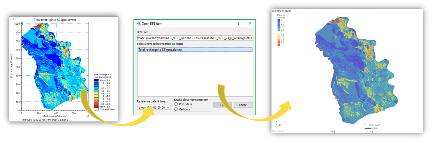
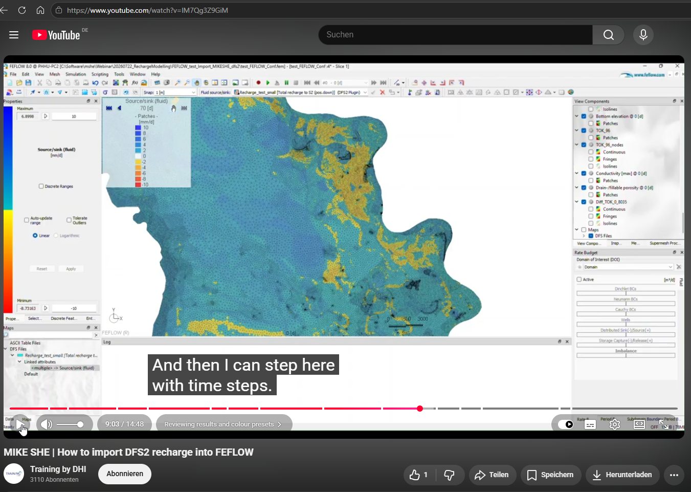
A complete step-by-step demonstration is available on YouTube.
Integration with MODFLOW
For MODFLOW, recharge is typically transferred to the RCH Package.
Because MIKE SHE stores recharge as DFS2 raster datasets while MODFLOW generally requires recharge values on the groundwater model grid, an interpolation step is required.
To preserve the total recharge volume during this conversion, DHI developed a Python workflow based on MIKE IO and FloPy using zonal statistics and mass-conservative interpolation.
The workflow supports
- MODFLOW-2005
- MODFLOW 6
- structured grids
- transient recharge
- steady-state recharge
The complete workflow is demonstrated in the following YouTube tutorial.
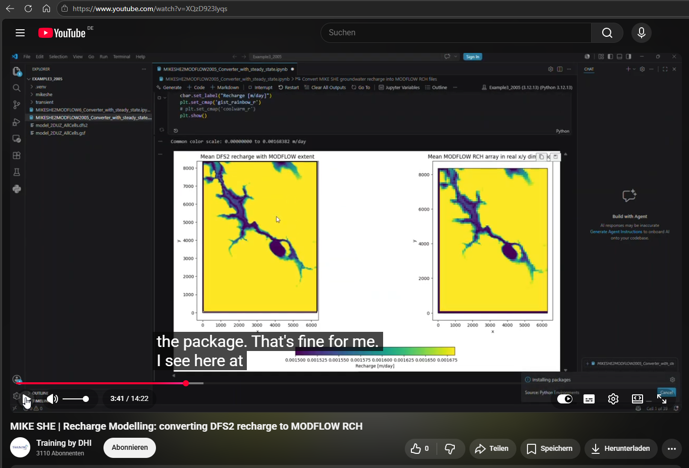
If Python is not yet installed, the following documentation explains the recommended software setup.
How to get started with Python
Download the MODFLOW recharge conversion tools
We provide three Jupyter Notebooks as a single ZIP download to convert MIKE SHE DFS2 recharge results into MODFLOW recharge input files.
- MODFLOW-2005 – converts DFS2 recharge to the MODFLOW-2005 RCH format. MODFLOW2005 Converter
- MODFLOW 6 – converts DFS2 recharge to the corresponding MODFLOW 6 recharge input. MODFLOW6 Converter
- MODFLOW-USG – supports structured DIS models; unstructured DISU models are not supported. MODFLOW USG Converter
All three workflows read the groundwater-model grid and stress periods, project the DFS2 recharge onto the model grid using MIKE IO and FloPy, and support transient and steady-state recharge. If you download the tools and encounter any difficulties when trying them on your own model, please do not hesitate to contact us at phhu@dhigroup.com.
Supporting Tools
The following software components are used within the recommended export workflow.
| Tool | Purpose |
|---|---|
| MIKE IO | Reading MIKE SHE DFS2 files |
| FloPy | Writing MODFLOW recharge packages |
| Python | Workflow automation |
| Visual Studio Code | Development environment |
Additional automation tools are continuously being developed to further simplify recharge export workflows.
Best Practice
Export recharge only after completing the interpretation of the recharge results. Recharge datasets should always represent a physically consistent water balance before being used as boundary conditions in groundwater flow models.
Common Pitfall
Avoid interpolating recharge between incompatible model grids without preserving the total recharge volume. Mass-conservative interpolation should always be preferred when transferring recharge to groundwater flow models.
6. Learning Hub
Key Message
The fastest way to become productive with MIKE SHE is to combine this written guide with the accompanying webinars and technical documentation.
Recommended Learning Path
The following learning path is recommended for most users.
Groundwater Recharge Fundamentals
              │
              ▼
Recharge Model Setup
              │
              ▼
Model Evaluation
              │
              ▼
Integration with MODFLOW / FEFLOW
              │
              ▼
Advanced Catchment Modelling
Getting Started
The following webinars provide a structured introduction to groundwater recharge modelling with MIKE SHE.
| Webinar | Recommended for |
|---|---|
| Recharge model without the 3D groundwater module | First-time users |
| Recharge model including the 3D groundwater module | Users building fully integrated recharge models |
Advanced Topics
Once the basic workflow is understood, the following webinars explain more specialised topics.
| Webinar | Focus |
|---|---|
| Postprocessing in MIKE SHE | Which outputs can be extracted and how to do it |
| Water Balance evaluations | Advanced water balance calculations |
| MODFLOW export workflow | Recharge conversion |
| FEFLOW workflow | Recharge import |
Best Practice
Combine this guide with the webinars rather than treating them as independent learning resources. Reading the documentation before watching the webinars significantly reduces the learning curve.
7. Further Information
Contact
If you would like to learn more about groundwater recharge modelling with MIKE SHE, the following support options are available.
Product Demonstration or Getting started guidance
Request a live demonstration of the groundwater recharge workflow with the current Business Owner:
Philipp Huttner
Business Owner – MIKE SHE
phhu@dhigroup.com
Training Licence
Apply for a complimentary one-month training licence including example datasets by submitting our online form:
https://www.dhigroup.com/technologies/mikepoweredbydhi/mike-she#ContactForm
Technical Support
If you have already a license as active user, reach out to the technical support for technical questions:
MIKE SHE Support
mike@dhigroup.com
Additional Resources
8. Scientific References and Case Studies
Estimated reading time: 10–20 minutes
This chapter provides an overview of published applications of MIKE SHE for groundwater recharge modelling from around the world.
Key Message
MIKE SHE has been applied successfully in a wide range of climatic, geological and hydrological settings for groundwater recharge estimation, integrated catchment modelling and groundwater resource assessment.
Why these publications matter
Physically based groundwater recharge modelling has been applied in numerous scientific studies and engineering projects worldwide.
The publications presented in this chapter demonstrate applications including
- groundwater resource assessment,
- recharge estimation,
- integrated groundwater–surface water modelling,
- climate-change studies,
- irrigation impacts,
- groundwater abstraction,
- groundwater model boundary conditions,
- regional water management.
Together, these examples illustrate the flexibility of MIKE SHE across different climatic conditions, geological settings and modelling objectives.
DHI Project Applications
The following table compiles publications and technical papers where MIKE SHE was used to simulate groundwater recharge, often as input or support for another groundwater model such as MODFLOW or FEFLOW.
| Continent (Country) | Publication | Authors | Online Source | Journal / Conference | Short Summary / Abstract |
|---|---|---|---|---|---|
| Continent (Country) | Publication | Authors | Online Source | Journal / Conference | Short Summary / Abstract |
| --- | --- | --- | --- | --- | --- |
| Africa (Malawi) | National Water Resources Modelling of Malawi Using MIKE SHE | Danish Hydraulic Institute (DHI) and partners | https://www.dhigroup.com/projects/malawi-water-resources-modelling | DHI Project Report | Distributed recharge modelling with MIKE SHE was performed to support groundwater-resource planning and climate-impact analysis across Malawi. |
| Africa (Botswana / Namibia / Angola) | Integrated Hydrological Modelling of the Okavango Catchment Using MIKE SHE | J. C. Refsgaard et al. | https://orbit.dtu.dk/en/publications/integrated-hydrological-modelling-of-the-okavango-river-basin | Journal of Hydrology | A large-scale MIKE SHE model of the Okavango Basin was developed to quantify recharge, groundwater–surface water interaction, and basin-scale hydrological processes in southern Africa. |
| Europe (Denmark) | Assessment of Exploitable Groundwater Resources of Denmark by Use of Integrated MIKE SHE Modelling | Henrik Møller et al. | https://pub.geus.dk/en/publications/assessment-of-exploitable-groundwater-resources-of-denmark-by-use | Geological Survey of Denmark and Greenland Bulletin | National-scale MIKE SHE simulations quantified recharge and groundwater availability for sustainable water abstraction planning. |
| Europe (Denmark) | Integrated Hydrological Modelling in the Karup Catchment, Denmark | J. C. Refsgaard and B. Storm | https://onlinelibrary.wiley.com/doi/10.1002/hyp.3360080504 | Hydrological Processes | One of the classical MIKE SHE applications demonstrating integrated recharge and groundwater-flow simulation in Denmark. |
| Oceania (New Zealand) | Integrated Catchment Modelling for Groundwater Recharge Assessment in New Zealand Using MIKE SHE | Environment Canterbury / DHI collaborators | https://www.dhigroup.com/projects/new-zealand-water-management | DHI Project Case Study | MIKE SHE was applied in New Zealand catchments to estimate distributed recharge and groundwater–surface water interaction for regional water-allocation planning. |
| South America (Brazil) | Integrated Hydrological Modelling of Tropical Catchments Using MIKE SHE in Brazil | ANA / DHI project team | https://www.dhigroup.com/projects/brazil-water-resources-management | DHI Project Case Study | MIKE SHE was used in Brazilian tropical basins to estimate recharge, river–aquifer exchange, and climate sensitivity for integrated water-resources planning. |
Independent Scientific Publications
| Continent (Country) | Publication | Authors | Online Source | Journal / Conference | Short Summary / Abstract |
|---|---|---|---|---|---|
| Africa (Nigeria) | Application of MIKE SHE Software for Estimation of Groundwater Recharge in Ogun and Oshun Basins, Southwestern Nigeria | A. O. Olarinoye et al. | https://www.researchgate.net/publication/340175451_Application_of_MIKE_SHE_Software_for_Estimation_of_Groundwater_Recharge_in_Ogun_and_Oshun_Basins_Southwestern_Nigeria | Hydrology Conference Proceedings / ResearchGate preprint | MIKE SHE was applied to estimate spatial and temporal groundwater recharge in southwestern Nigeria. Recharge estimates were generated for regional groundwater assessment and water-resources planning. |
| Africa (South Africa) | Groundwater Recharge Estimation in the Mokolo River Basin Using MIKE SHE | Various authors | https://www.wrc.org.za/wp-content/uploads/mdocs/TT%20522-12.pdf | Water Research Commission Report (South Africa) | MIKE SHE was used to simulate recharge dynamics in a semi-arid South African basin. Results supported integrated groundwater management and aquifer assessment. |
| Africa (South Africa) | MIKE SHE Modelling of the Mhinga Aquifer, Limpopo Province | Council for Geoscience South Africa et al. | https://www.geoscience.org.za/images/Projects/Water/groundwater_modelling_mhinga.pdf | Council for Geoscience Technical Report | Distributed recharge and aquifer response were simulated with MIKE SHE to support sustainable groundwater management in a semi-arid South African aquifer system. |
| Africa (South Africa) | Recharge Processes in Semi-Arid Southern Africa Simulated with MIKE SHE | Multiple authors | https://www.sciencedirect.com/science/article/pii/S0022169404001234 | Journal of Hydrology | MIKE SHE was used to analyse recharge variability under semi-arid climatic conditions and evaluate impacts on groundwater sustainability. |
| Asia (China) | Modelling Groundwater Flow with MIKE SHE Using Conventional Climate Data and Satellite Data as Model Forcing in Haihe Plain, China | Yunqiao Shu, Hongjun Li, Yuping Lei | https://www.mdpi.com/2073-4441/10/10/1295 | Water (MDPI) | The study used MIKE SHE to simulate evapotranspiration, recharge, and groundwater dynamics in the Haihe Plain. Recharge estimates were linked to regional groundwater-flow assessment. |
| Asia (China) | Integrated Hydrological Modelling of the North China Plain: Options for Sustainable Groundwater Management | J. C. Refsgaard et al. | https://pub.geus.dk/en/publications/integrated-hydrological-modeling-of-the-north-china-plain-options | Hydrogeology Journal | MIKE SHE was applied to simulate recharge and groundwater depletion under agricultural stress in the North China Plain. |
| Asia (China) | Distributed Hydrological Modelling in the Tarim River Basin Using MIKE SHE | Various authors | https://www.sciencedirect.com/science/article/pii/S0022169413004506 | Journal of Hydrology | MIKE SHE was used to evaluate recharge and groundwater interactions in an arid inland basin in western China. |
| Asia (India) | Application of MIKE SHE in Semi-Arid Watershed Hydrology in India | P. K. Mishra et al. | https://www.researchgate.net/publication/305687492 | International Journal of Hydrology Science and Technology | Recharge and groundwater response in a semi-arid Indian catchment were simulated using MIKE SHE to support regional aquifer studies. |
| Asia (Bangladesh) | Integrated Surface Water–Groundwater Modelling in Bangladesh Using MIKE SHE | Various authors | https://iwaponline.com/hr/article/42/5/757/913 | Hydrology Research | MIKE SHE was used to quantify recharge and groundwater interaction under monsoon-driven hydrological conditions. |
| Europe (Greece) | Integrated Water Resources Assessment Using MIKE SHE and FEFLOW Modelling Systems in Rodopi Prefecture, Greece | K. Voudouris et al. | https://www.researchgate.net/publication/343548335_Integrated_water_resources_assessment_using_MIKE_SHE_and_FEFLOW_modelling_systems_in_Rodopi_Prefecture_Greece | Environmental Earth Sciences / Conference Paper | Recharge estimated with MIKE SHE was transferred to a FEFLOW groundwater-flow model to analyse groundwater management and irrigation impacts. |
| Europe (Denmark) | Climate Change Impact on Groundwater Recharge in Denmark Simulated by MIKE SHE | Refsgaard et al. | https://www.sciencedirect.com/science/article/pii/S0022169406001902 | Journal of Hydrology | MIKE SHE was used to evaluate future recharge under climate-change scenarios and assess implications for Danish groundwater resources. |
| Europe (Denmark) | Distributed Hydrological Modelling of Clayey Till Catchments in Denmark | Stisen et al. | https://hess.copernicus.org/articles/15/2401/2011/ | Hydrology and Earth System Sciences | The study applied MIKE SHE to simulate recharge and groundwater flow in lowland agricultural catchments with shallow aquifers. |
| North America (Canada) | An Integrated Modelling Approach for Groundwater Recharge Estimation in Ontario, Canada | Multiple authors | https://www.sciencedirect.com/science/article/abs/pii/S0022169408005532 | Journal of Hydrology | MIKE SHE-derived recharge estimates were used to support regional groundwater modelling and aquifer-management studies in Ontario. |
| North America (Canada) | Groundwater Recharge Estimates in Mine Site Using MIKE SHE as Input to FEFLOW | Mundzir Basri, Miad Jarrahi, et al. | https://www.mineconferences.com/bluepixeldesign/wp-content/uploads/2022/07/28.-Mundzir-Basri-Miad-Jarrahi-Pramod-Pokharel-Estefany-Tisza-Groundwater-Recharge-Estimates-in....pdf | Mine Water 2022 Conference | MIKE SHE was used to estimate spatially distributed recharge for use as input to a 3D FEFLOW groundwater model simulating mine impacts. |
| North America (Canada) | Integrated Hydrological Modelling of the Okanagan Basin | Various authors | https://www.researchgate.net/publication/228890994 | Canadian Water Resources Journal | MIKE SHE simulations quantified recharge and groundwater–surface water interaction under climate variability in western Canada. |
| North America (USA) | Simulation of Recharge in Fractured Sandstone Aquifers Using MIKE SHE | Various authors | https://pubs.usgs.gov/publication/70029912 | Hydrogeology Journal | Recharge dynamics in fractured aquifers were simulated with MIKE SHE to support groundwater-flow assessments. |
| North America (Canada) | Groundwater–Surface Water Interaction Modelling in Ontario Moraine Systems | Various authors | https://www.researchgate.net/publication/237463051 | Journal of Hydrology | MIKE SHE was used to estimate recharge and groundwater discharge processes in moraine aquifer systems. |
| Oceania (Australia) | Integrated Surface Water and Groundwater Modelling in the Wakool Catchment, Australia | L. Zhang et al. | https://www.sciencedirect.com/science/article/abs/pii/S1364815298000644 | Environmental Modelling & Software | MIKE SHE was used to quantify recharge and groundwater interactions in irrigated Australian catchments. |
| Oceania (Australia) | Climate Sensitivity of Groundwater Recharge in Australia Using MIKE SHE | Various authors | https://www.sciencedirect.com/science/article/pii/S0022169407002174 | Journal of Hydrology | Recharge responses to changing climate conditions were simulated with MIKE SHE in Australian basins. |
| Oceania (Australia) | Integrated Modelling of the Loddon River Catchment with MIKE SHE | Multiple authors | https://www.researchgate.net/publication/248824429 | Hydrological Processes | The model simulated recharge and groundwater interactions in a highly managed agricultural catchment in southeastern Australia. |
| Oceania (Australia) | Groundwater Recharge and Irrigation Return Flow in the Murray Basin | Various authors | https://www.mdpi.com/2073-4441/8/2/45 | Water (MDPI) | MIKE SHE simulations were used to quantify recharge and irrigation return flow under semi-arid Australian conditions. |
| Oceania (Australia) | Comparative Groundwater Flow Simulation Using MIKE SHE and MODFLOW | F. Akram et al. | https://flair.monash.edu/intranet/proceedings/18afmc/Documents/344%20-%20Akram.pdf | MODSIM / AFMC Proceedings | Comparative assessment of MIKE SHE and MODFLOW groundwater-flow simulation capabilities, including recharge representation and integrated hydrological processes. |
| South America (Regional / Tropical Basins) | Integrated Hydrological Modelling Approaches Applicable to South American Recharge Studies | Various authors | https://www.sciencedirect.com/science/article/pii/S0022169411005120 | Journal of Hydrology | Review-style paper discussing integrated recharge modelling approaches including MIKE SHE for large South American basins. |
| South America (Regional / Tropical Basins) | Distributed Recharge Estimation Methods for Tropical Basins | Various authors | https://iwaponline.com/hr/article/43/6/1117/1020 | Hydrology Research | Comparative recharge-modelling study referencing MIKE SHE methodologies for tropical groundwater systems. |
| South America (Colombia) | Conceptual and Distributed Recharge Modelling for Colombian Basins Using MIKE SHE | Universidad Nacional de Colombia collaborators | https://repositorio.unal.edu.co/handle/unal/69345 | University Technical Thesis / Report | MIKE SHE-based recharge simulations were used to analyse groundwater availability and recharge variability in Andean catchments. |
| South America (Chile) | Integrated Surface Water–Groundwater Simulation in Northern Chile Using MIKE SHE | DGA Chile / consulting consortium | https://www.arcadis.com/en/projects/chile/integrated-water-management-chile | Engineering Project Case Study | MIKE SHE was used to quantify recharge and groundwater interaction in arid northern Chilean basins influenced by mining and water abstraction. |
Best Practice
When developing a new recharge model, reviewing published studies from catchments with similar climatic and hydrogeological conditions can provide valuable guidance for selecting an appropriate model complexity and calibration strategy.
Thank you for using MIKE SHE.
Whether your objective is groundwater resource assessment, recharge estimation for MODFLOW or FEFLOW, climate-change analysis or integrated catchment modelling, we hope this guide helps you develop physically realistic groundwater recharge models with confidence.