Create a Data Collection Mask
The data collection mask defines the area from which input data will be collected and prepared for the MIKE SHE model. The mask should extend beyond the model domain to ensure that all MIKE SHE grid cells receive valid input data, particularly along the model boundaries.
-
Ensure that the model domain layer has been created and saved.
-
Open the Processing Toolbox by selecting Processing → Toolbox.
-
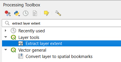
Search for and open the Extract Layer Extent tool.
-
Select the model domain layer as the input layer.
-
Specify an output location or leave it as Temporary Layer, then click Run.
-
A new polygon layer representing the extent of the model domain will be created.
-
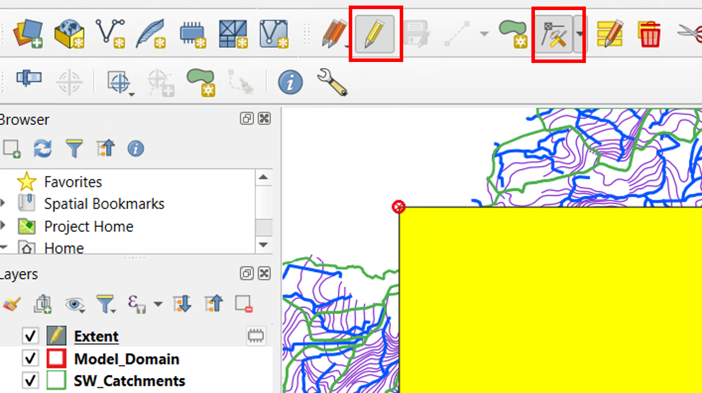
Start editing the extent layer by clicking Toggle Editing.
-
Select the Vertex Tool from the Digitizing toolbar.
-
Right-click on the extent polygon to display its vertices and open the Vertex Editor panel.
-
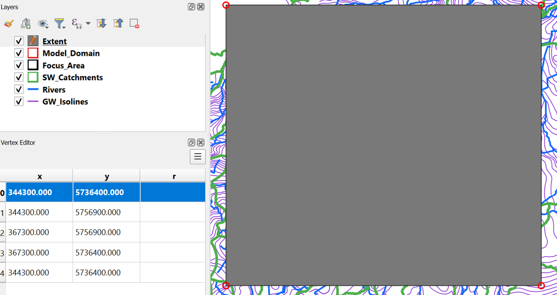
Review the coordinates of the corner vertices and adjust them to:
-
Extend beyond the model domain boundaries.
- Align with the planned MIKE SHE grid resolution (e.g. multiples of 50 m, 100 m, or 200 m).
Example
Original extent:
- Xmin = 344838.24430000037
- Xmax = 366827.18510000035
- Ymin = 5736975.610400001
- Ymax = 5756386.485400001
Adjusted extent for a 100 m model grid:
- Xmin = 344300
- Xmax = 367300
- Ymin = 5736400
-
Ymax = 5756900
-
Modify the coordinates of the four corner vertices in the Vertex Editor:
-
Lower left corner: Xmin, Ymin
- Lower right corner: Xmax, Ymin
- Upper right corner: Xmax, Ymax
- Upper left corner: Xmax, Ymax
-
Lower left corner (again to finish geometry): Xmin, Ymin
-
Verify that the polygon forms a rectangular extent matching the adjusted coordinates.
-
Save the edits and disable editing mode.
-
Save the edited extent polygon as a permanent layer by right-clicking the layer and selecting Export → Save Features As...
-
Save the layer and select an appropriate output format (e.g. GeoPackage or Shapefile).
-
Add the saved layer to the project and remove the temporary extent layer if no longer needed.
Note
The data collection mask should always be larger than the model domain. Whenever possible, the mask boundaries should be aligned with the planned MIKE SHE grid resolution. This simplifies raster processing, ensures consistent alignment between all model input layers, and helps avoid resampling issues and edge effects during model setup.
The Data Collection Mask will serve as the standard processing extent for subsequent data preparation steps.
Click here to jump to the next section: